 |
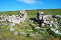
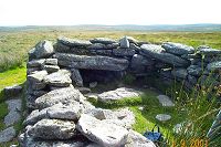
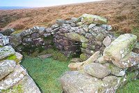
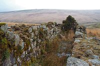
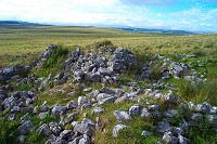
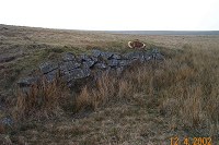
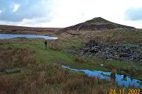
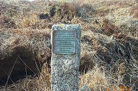
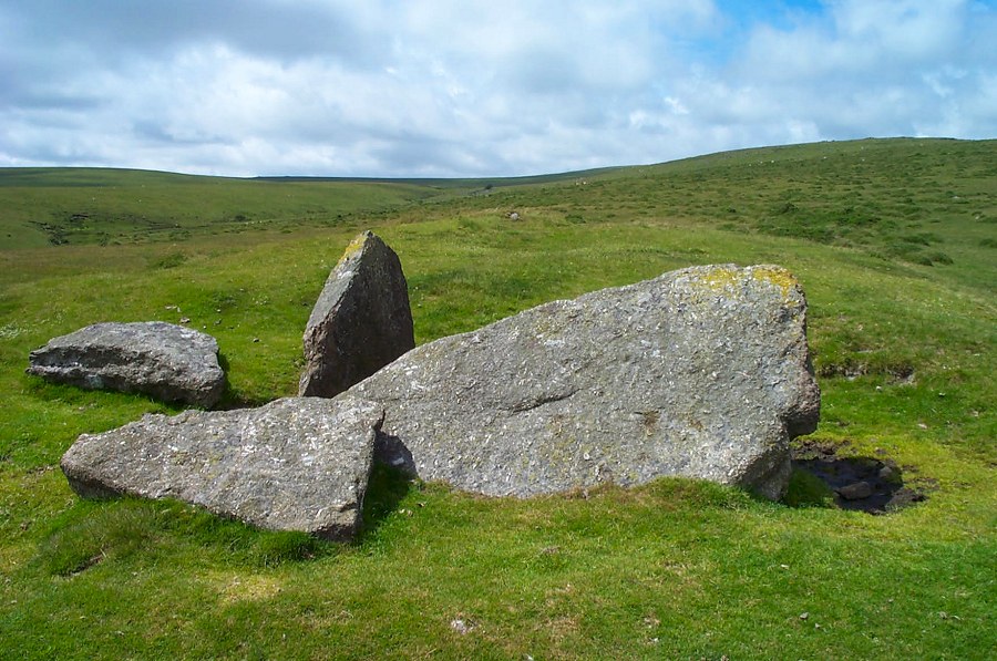
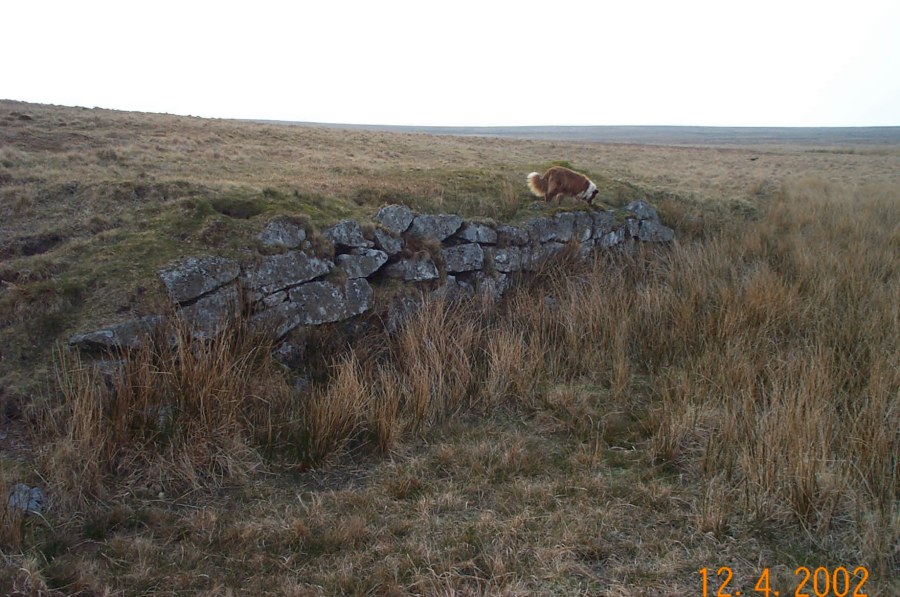
The collapsed Neolithic long barrow at Corringdon Ball Gate (SX
670614). This is one of the oldest human remains on the
moor - 3000 BC?
Brent Fore hill on the right.
|
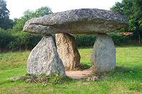 |
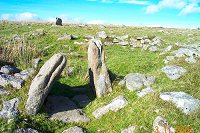
Spinster Rock at Shilstone - SX 703909. Another Neolithic burial
chamber.
|
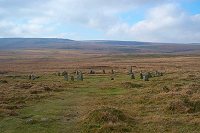 |
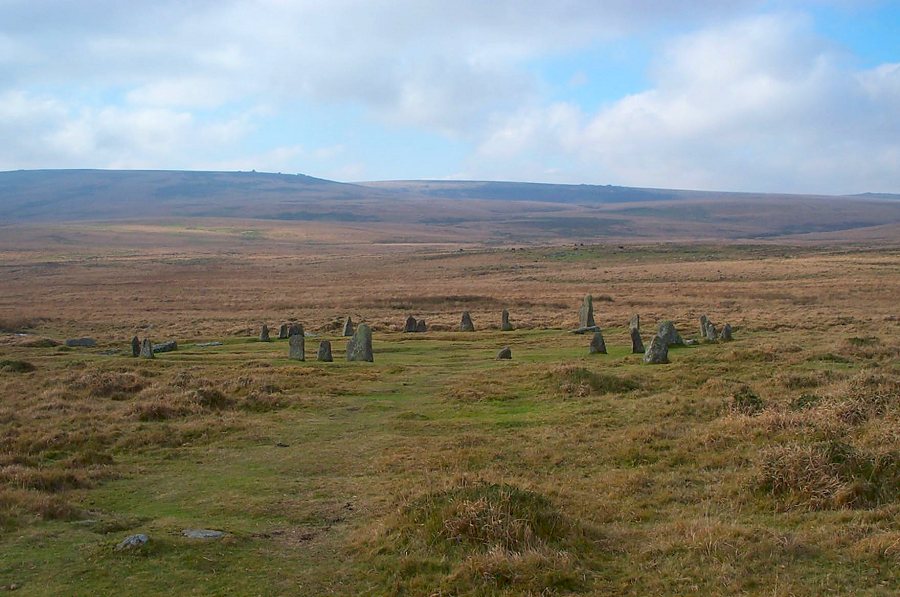
Scorhill stone circle. Watern Tor and Wild Tor are on the skyline.
|
 |
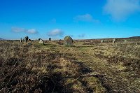
Part of the Grey Wethers stone circle (SX 639831). Wethers is
an old name for sheep - at a distance maybe the stones look like
a load of sheep.
|
 |
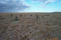
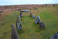
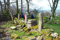
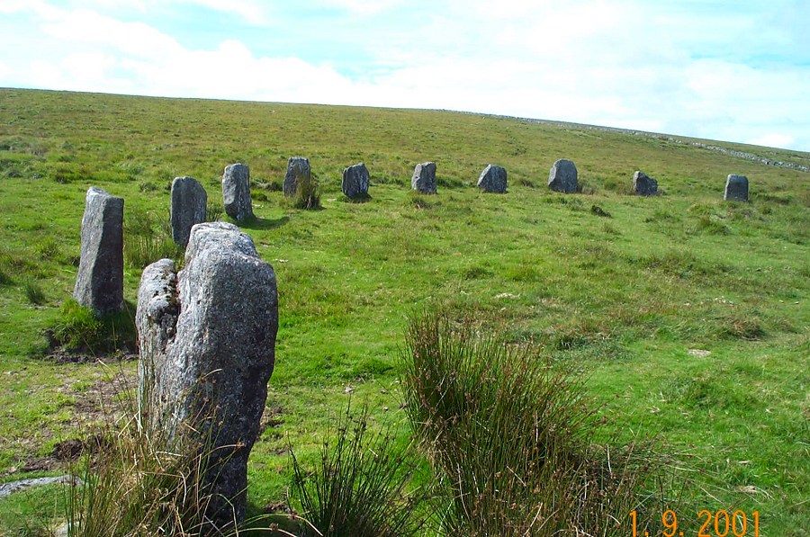
The stone circle (SX 633897) near to White Moor Stone.
|
 |
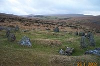
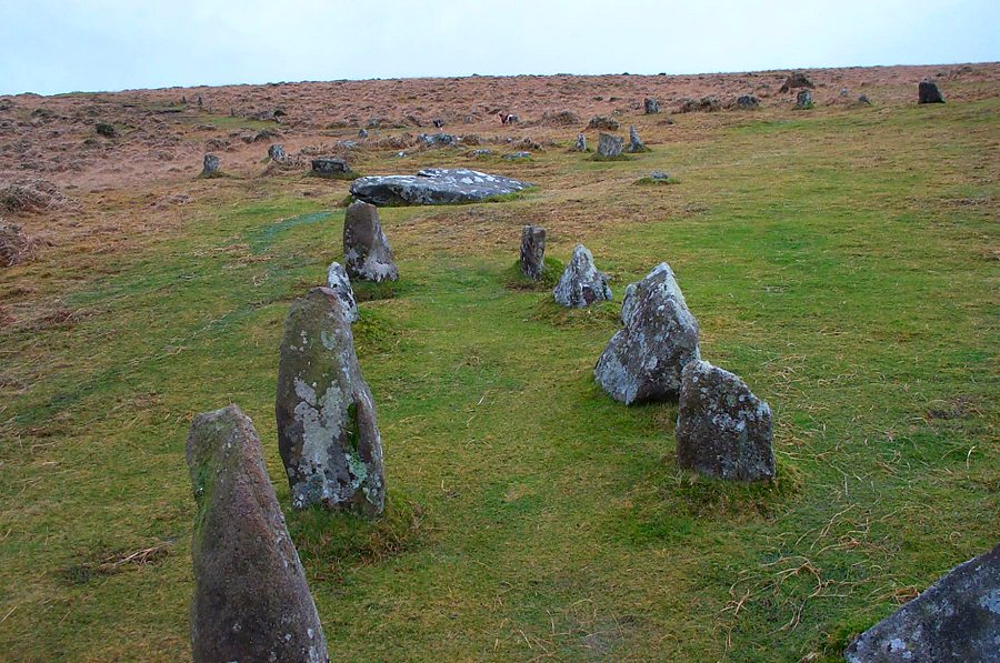
A stone circle (SX 563658) near Legis Tor with a row behind.
|
 |
The Nine Maidens circle on Watchet Hill at SX 613928. There are
more than nine stones here but the name probably refers to some
pagan nature religion where nine had some significance. In the
distance lie West Mill and Yes Tors.
|
 |
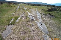
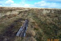
Near the start of the longest stone row in the world - SX 635645.
Over 2 miles long it ends at a cairn on Green Hill.
|
 |
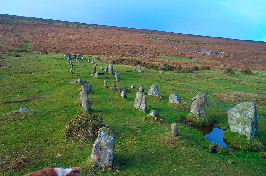
A stone row on Chagford Common (SX 669860)
|
 |
The Cornwood Maidens - part of the Staldon stone row that strides
across the top of the hill. The row is from the Bronze age. Stall
moor and the Erme valley are in the background.
|
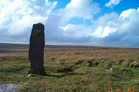 |
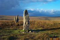
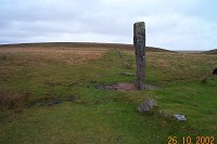
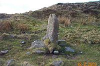
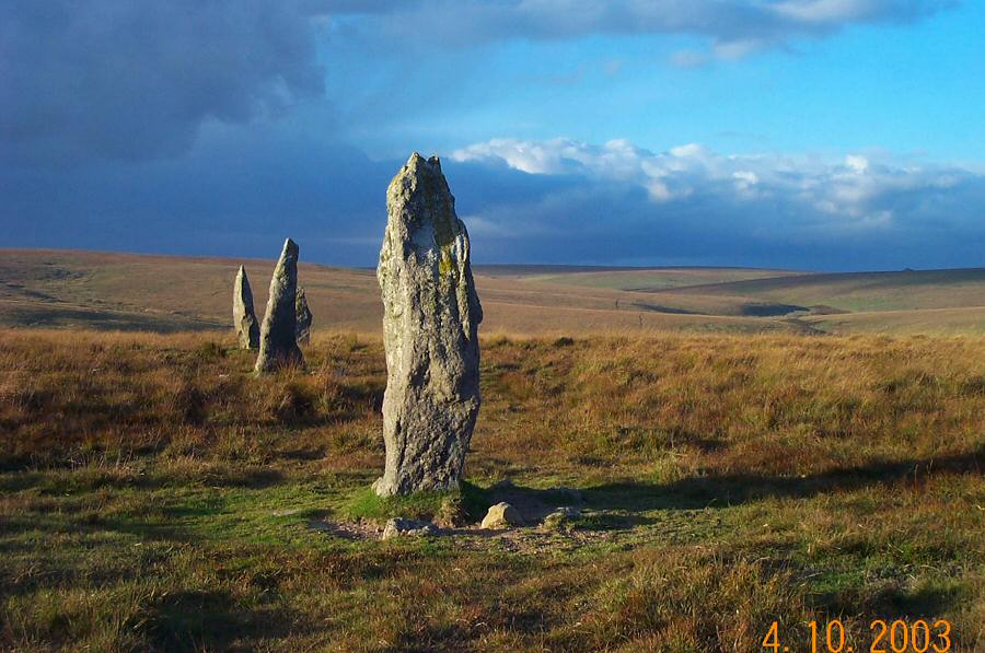
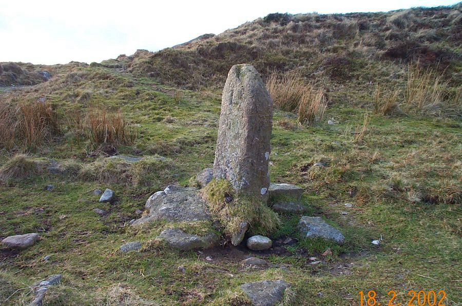
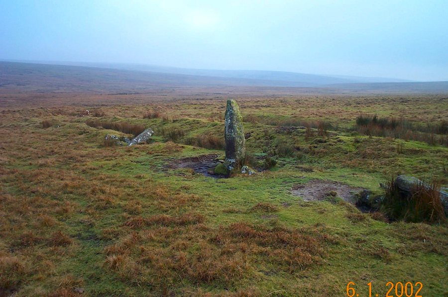
The menhir of Beardown Man (SX 596797).
|
 |
One of the stone rows at Drizzlecombe (SX 591669).
|
 |
An impressive triple stone row (known as The Graveyard) that
runs W- E on Cheriton Combe plain at SX 644915. This shows the
western part. The eastern part of the row has suffered from stone
robbing.
|
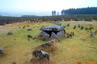 |
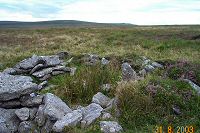
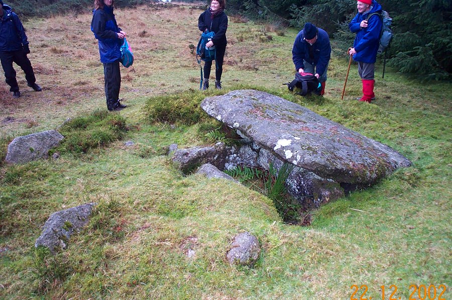
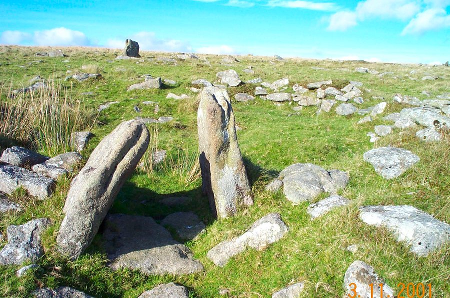
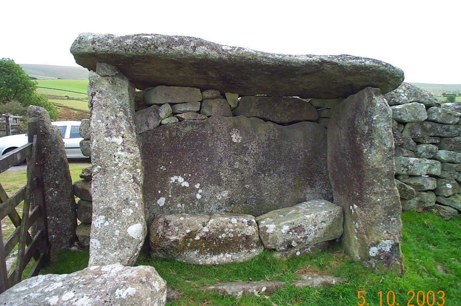
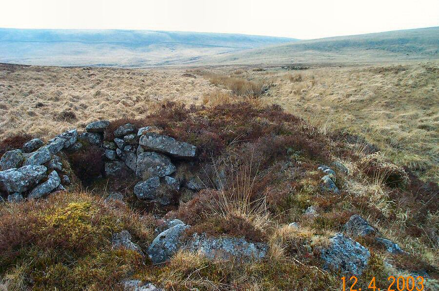
An excellent example of a chambered tomb with a stone row at
SX 646776.
|
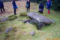 |
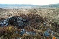
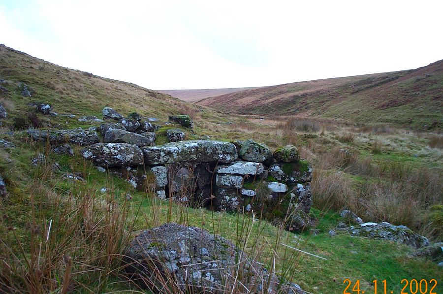
A burial mound at SX 641765. This one has a well preserved cist
with a good capstone.
|
 |
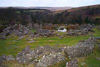
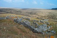
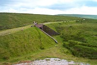
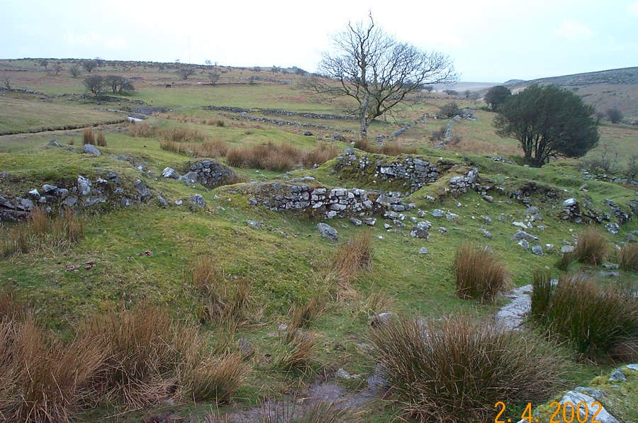
The southern entrance to Grimspound. Grimspound was probably
occupied around 1300 BC.
|
 |
One of the old hut circles that are found on Willsworthy Range
at SX 550834
|
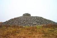 |
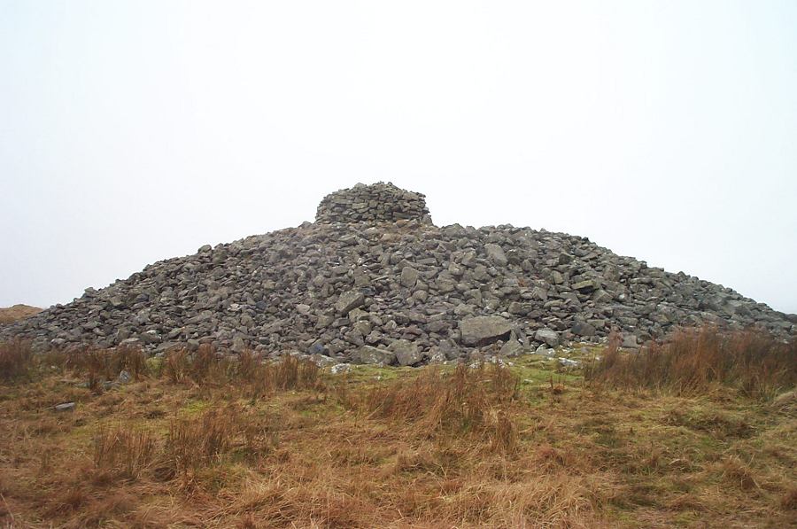
The Eastern White Barrow (SX 665652) - a Bronze Age cairn.
It is a commanding structure - a streamlined heap of granite with
a circular tower of stones. It looks rather like an early submarine,
but is a burial structure. |
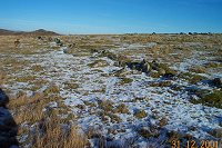 |
A Bronze age reave at SX 680718. This is part of the extensive
Holne reave system which was a set of enclosed fields and homesteads
made when conditions on Dartmoor were a bit easier than they are
today.
|
 |
Round Pound. This lies on the road to Batworthy and is part
of an old settlement complex - probably Bronze Age. In the background
lies the gorge of the North Teign stream.
|
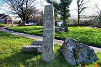 |
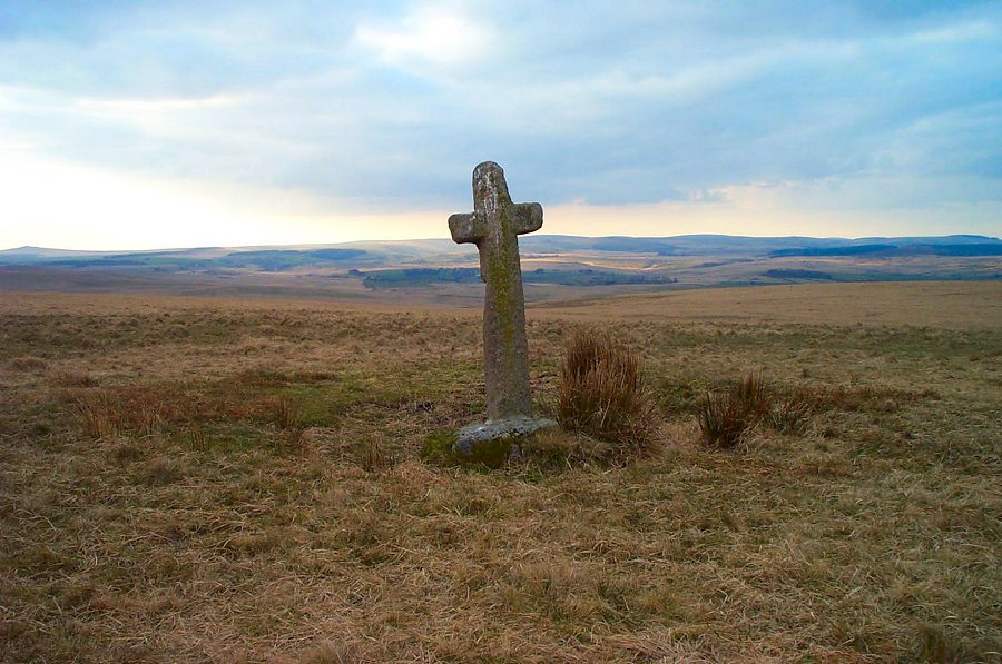
The Saxon cross of Sourton village green - SX 534903. This
was set up near the church in 1985. |
 |
Siward or Nun's Cross with the farmhouse behind. This cross dates
from the 13th century. It was vandalised and repaired in 1846.
Crane Hill is on the horizon.
|
 |
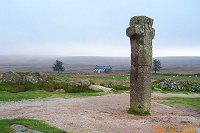
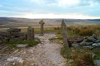
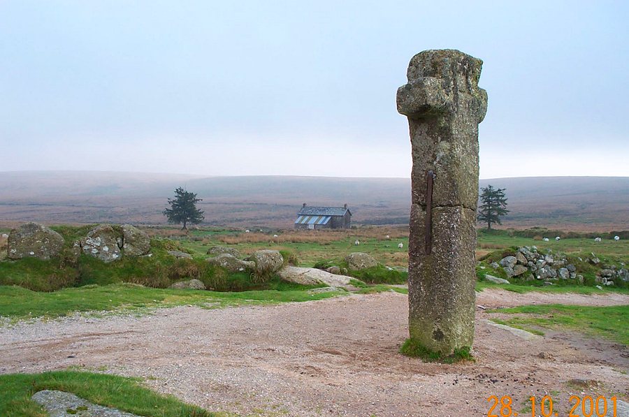
Windypost Cross - SX 533743. This is a 16th century (or older) guide post
that probably helped the wool farming monks of Tavistock when they
crossed the moor.
|
 |
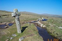
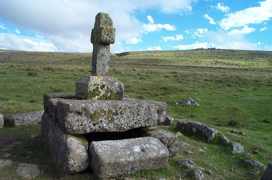
Childe's Tomb. The cross is medieval and maybe earlier. The
cairn is probably Bronze Age. (SX 626703). There is a rather silly
legend
associated with this place. Horse carcasses, burial, storms and monks
are all involved.
|
 |
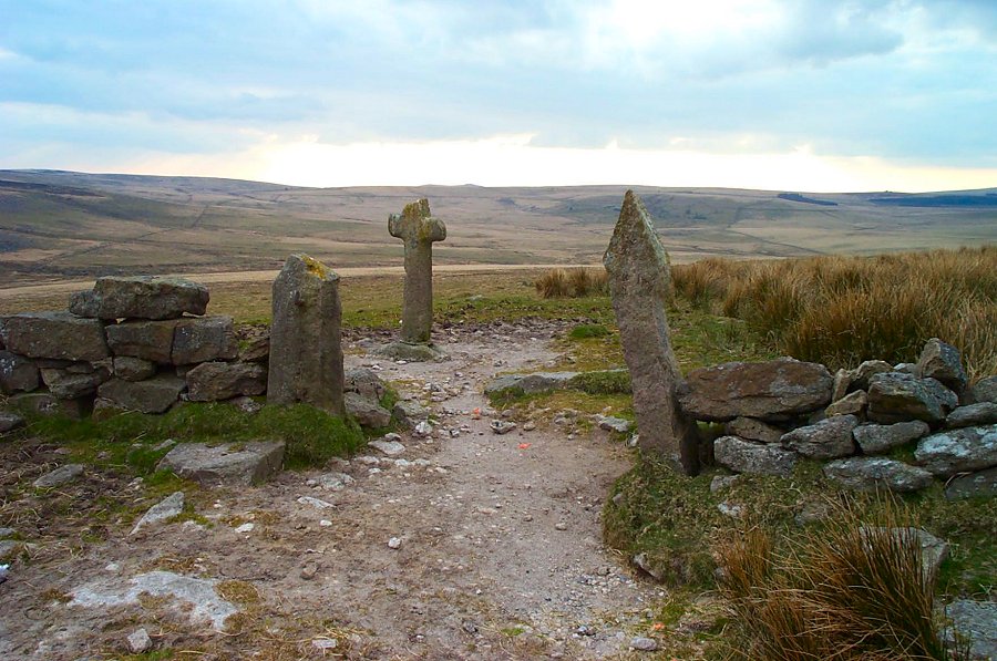
A cross at SX 642708 near the summit of Ter Hill.
|
 |
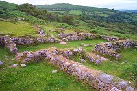
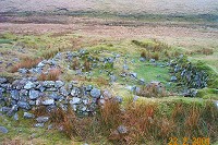
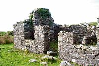
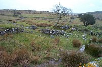
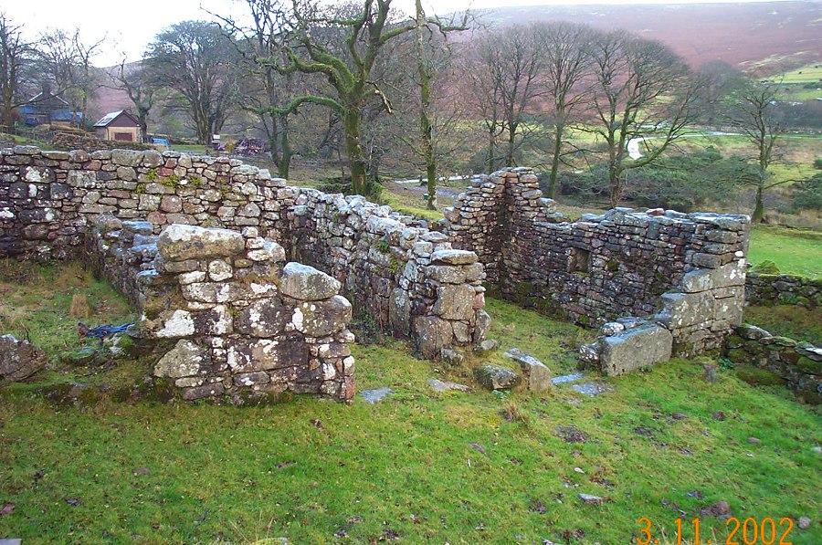
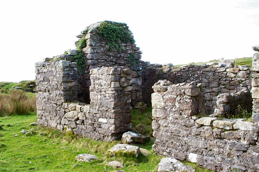
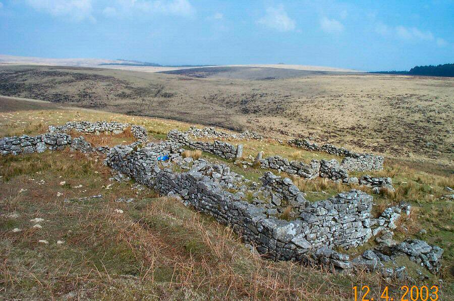
Some of the remains of the medieval village of Challacombe at
SX 694795.
These were probably vacated during the plague of 1348.
|
 |
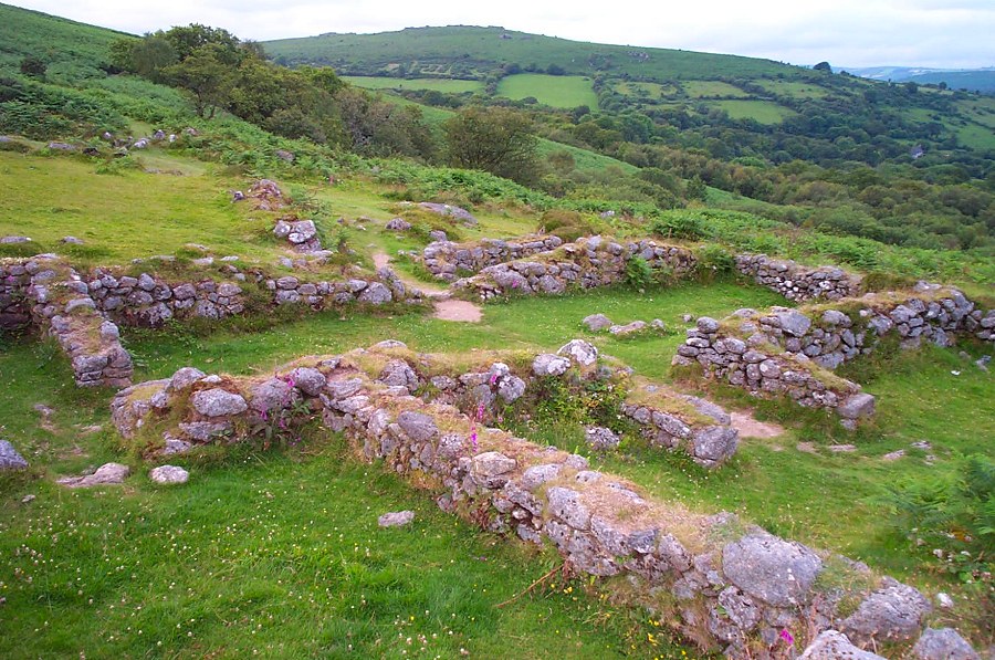
One of the largest houses of the Hound Tor medieval village at
SX 747788. The porch way is substantial. Inside the long room
are
a few stones
that
mark where the hearth
would have been. There are a number of smaller rooms.
|
 |
The village stocks of Belstone. The offender would have sat on
the granite stone with his legs held in the stocks. With nothing
to lean back on as well as receiving other insults coming his way
- this would be an uncomfortable if not painful experience.
|
 |
The Judges's Chair at Dunnabridge Pound - SX 645746. Probably
built in the 16th century the pound derives from a prehistoric
enclosure and was used to impound
stray
animals found on the moor. |
 |
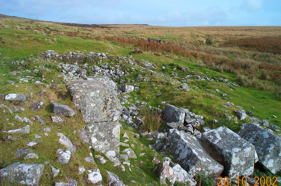
The grassy spoil tips of Erme Pits at SX 622669. These are the
substantial remains of an old tin mine. On the horizon appears
the Red Lake pyramid.
|
 |
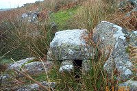
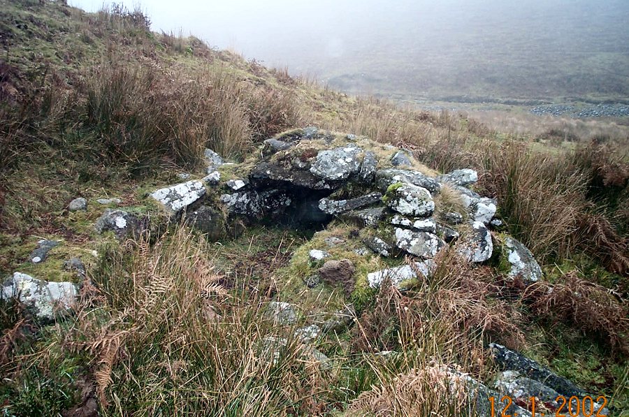
Downing's house (SX 639629). This is a medieval tinner's beehive
shelter where tools and tin ingots were probably stored. It is
too small to be a shelter. Originally it would have been covered
by turf.
|
 |
A well preserved medieval tinner's hut beside the Steeperton Brook - SX
621882.
|
 |
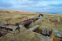
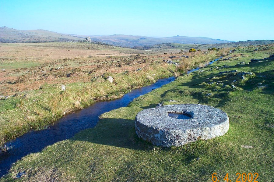
One of the tin stamping mills at Black Tor Falls - SX 5747166.
The wheelpit that housed the waterwheel that drove the stamps would
have been
just left of the mortarstone.
|
 |
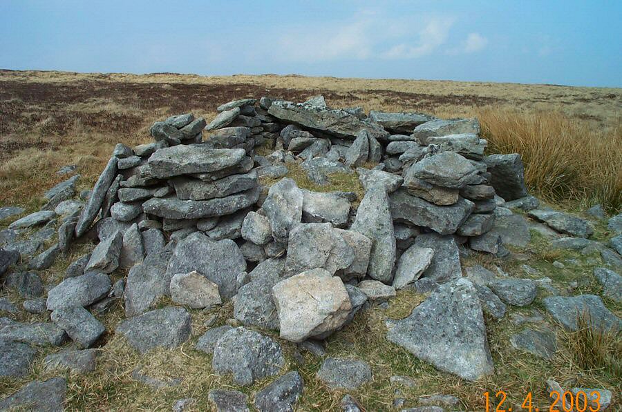
The ruins of Moute's Inn (SX 618853) - a peat cutter's shelter.
|
 |
The fireplace of Statts house (SX 621825). As you can see this
is a pretty small shelter for 18th century peat cutters.
|
 |
Remains of a peat cutter's shelter on Whitehorse Hill at SX 617848.
|
 |
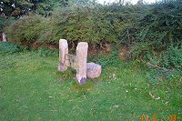
A boundary stone near Dick's Well at SX 551861. It marks the
division between Bridestowe and Sourton parishes. BS is inscribed
on the stone.
|
 |
This is what the OS map calls a tinner's hut (SX 628842). Maybe
it's a shepherd's hut or some other shelter. It lies beside Great
Varracombe.
|
 |
A view of Will May's House on Gidleigh Common (SX 639868) that
shows the fireplace built into the walls. This was a peat cutter's
shelter used in the 1780's.
|
 |
Remains of a tin blowing house near Broad Falls, Avon - (SX 653670).
|
 |
Remains of the tin miner's shelter at Wheal Prosper. Wheal Prosper
(SX 573794) was an old tin working that was anything but prosperous.
|
 |
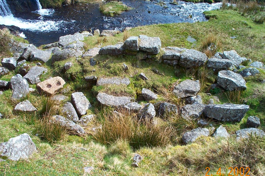
The blowing house near Glaze Meet (SX 668604). A double mortarstone
is clearly visible while to the left is a tin ingot mould.
|
 |
A derelict water wheel pit - SX 665664 part of the old tin mine
of Devon Wheal Vor that closed down in 1815 but reopened for a
short while
in 1866 as the Huntingdon Mine.
|
 |
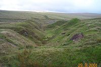
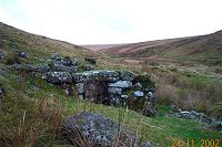
Looking SE from the remains of Turf House (an old peat store)
over the upper reaches of the lonely Walkham Valley.
On the left middle horizon lies the desolate waste of Maiden Hill. SX
569809.
|
 |
Substantial ruins of the tin mine at Wheal Frederick - SX 545854.
The building was probably accommodation or offices.
|
 |
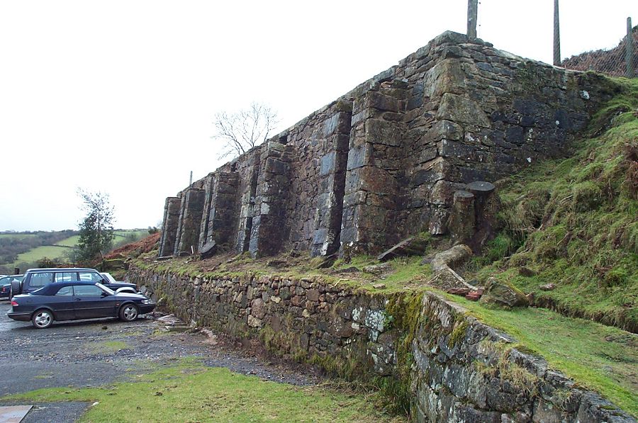
The remains of a smelting house near Eylesbarrow Tin mine -
SX 592676. There were 2 furnaces. The picture shows what's left
of
the blowing furnace
with its fallen blocks. This was working in 1826.
|
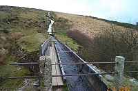 |
Devonport Leat hurtles down the side of Raddick Hill and passes
swiftly over the viaduct.
|
 |
A splendid wheelwright's stone lying beside the Sortridge leat
- SX 537748. This was used to fit a metal tyre onto a wooden wheel.
The wheel hub fitted into the central socket while the work was
being done.
There was a lot of granite working in this area and carts needed
to be well shod so as to cope with the rough tracks.
|
 |
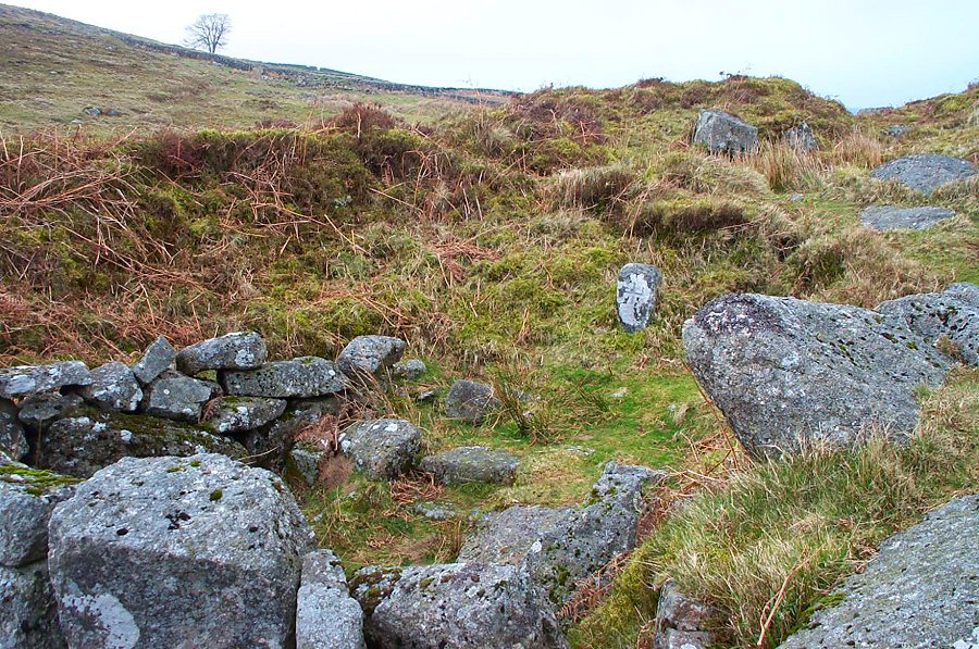
The remains of Manga Farm (SX 639849). This isolated place has
a lovely atmosphere but didn't last long as a going concern.
Built around 1800 - by 1884 it was in ruins.
|
 |
The remains of Fox Tor farm (SX 629705). These date from 1820
or so but the farm was abandoned in 1863 after a lot of effort
was made in trying to build a viable farm on the unpromising land.
|
 |
Mount Misery Corner- SX 637706. The views from here are splendid.
This was a farm enclosure overlooking Fox Tor mire.
|
 |
Lots of old farm enclosures scattered around the Devonport Leat at
SX 570710
|
 |
Hamlyn's leat at SX 675715. It was used to help
power a Buckfastleigh woollen mill. Yar Tor and Sharp Tor are on
the horizon with the wooded valley of Dartmeet on the left. As
you can see Hamlyn's leat is still flowing - although the mill
has long closed down.
|
 |
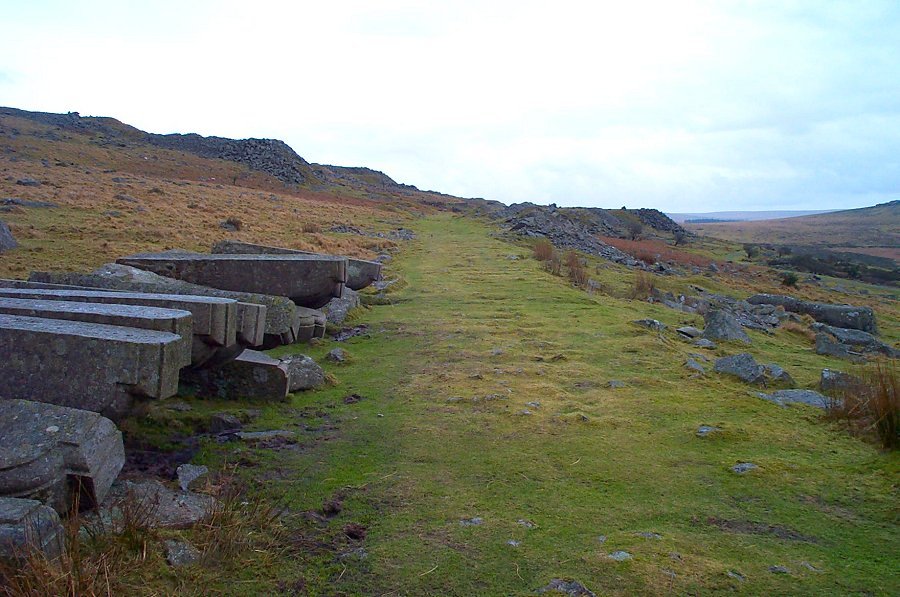
The junction along the Hey Tor granite railway (SX 757778) where the siding descends to Holwell
quarry. The hole in the granite housed a pole which was used to
direct the trucks down the right line.
|
 |
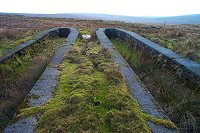
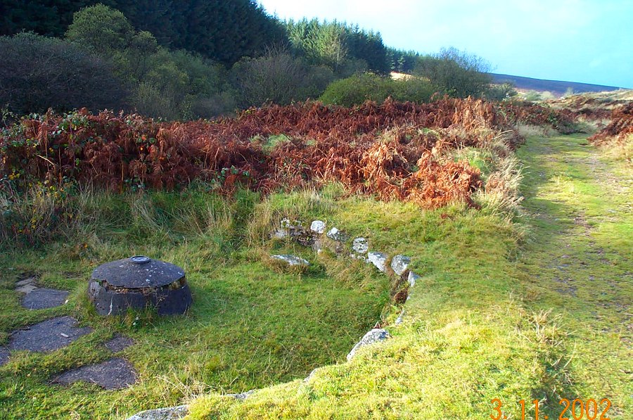
Remains of the peat packing wharf at the terminus of
the old peat tramway that transported peat into Dartmoor prison
- SX 575770. Peat turfs were brought off the moor to here by packhorses. The tramway consisted of horsedrawn trucks along iron rails.
It
was used to fuel the naptha works that lit the prison in the mid
1850's.
|
 |
The track leading into Swell Tor quarry. On the left are partially
finished corbels for London Bridge which were never collected.
This is part of the Kings Tor railway that was used for transporting granite
from the quarries.
|
 |
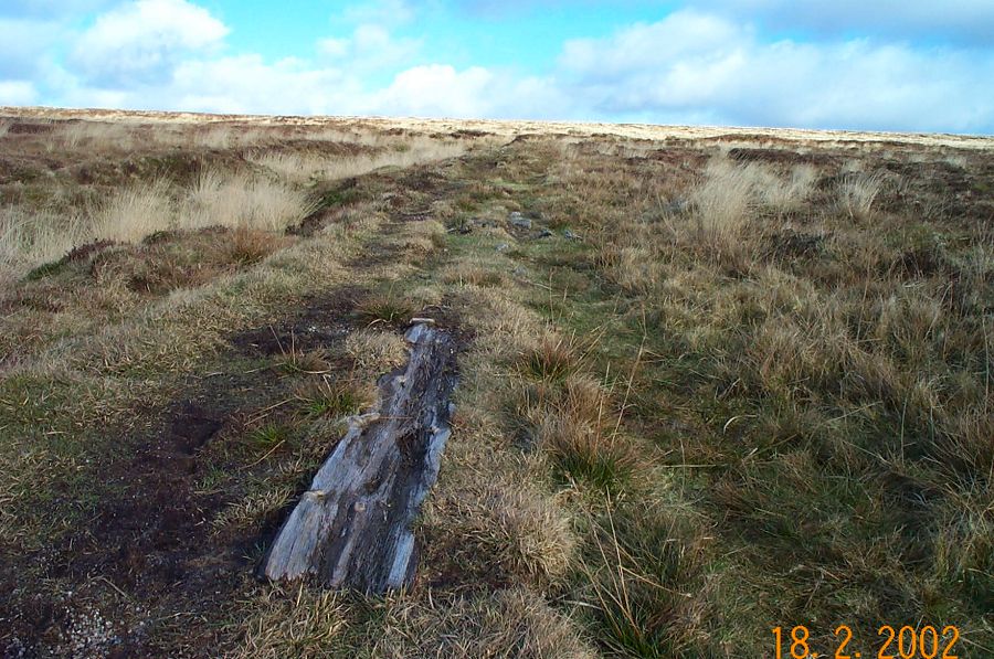
Remains of a wood based tramway that transported peat down from
Amicombe Hill to the Peat works at Rattlebrook.
|
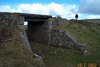 |
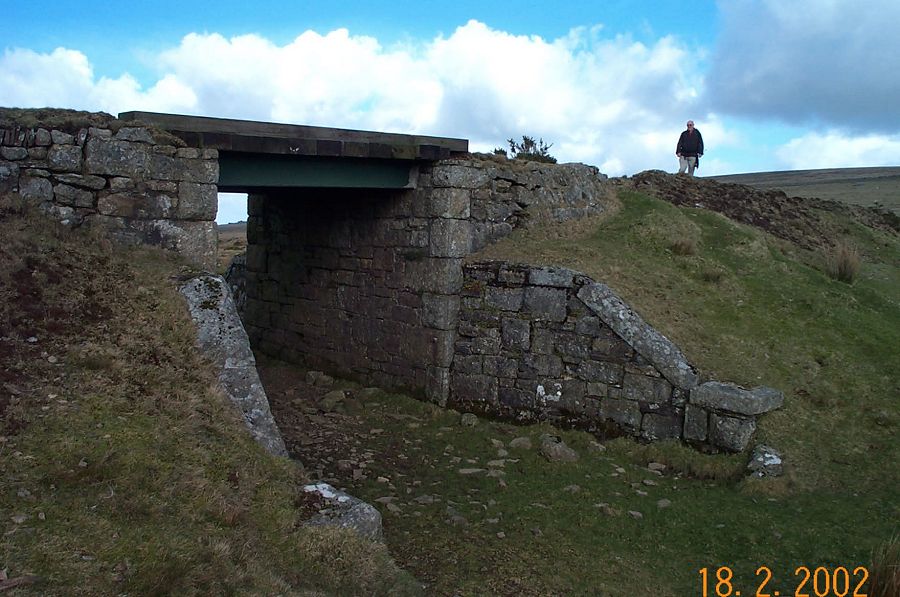
The railway bridge at SX 543880. Part of a windy narrow gauge
railway that stretched nearly 5 miles from Bridestowe station up
to the desolate platform of Rattlebrook
some 350m above. It was used to transport peat.
|
 |
The railway bridge at Left Lake (SX 647635). This was part of
the "Puffing
Billy" track - or the Red Lake clay rail track. The track
was lifted in the mid 1930's.
|
 |
Red Lake (SX 646669). Remains of some of the works
are on the right with the spoil tip behind.
|
 |
The Red Lake sand pits just south of Crossways. China clay was
discharged into these pits and allowed to settle before the slurry
was flowed down by pipeline towards Ivybridge. In the far background
lies Plymouth.
|
 |
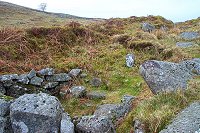
A vermin trap on the south side of Legis Tor.
|
 |
A flood relief sluice by the Devonport leat at SX 608698. The
path over the bridge leads onto the Abbot's way. Near Nun's Cross.
|
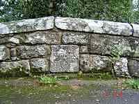 |
Drakeford Bridge (SX 789801) has a good tablet on the
downstream arch entitled "This 1684/Bridg Was/Repard/by The /Covnty".
In 1809 the County Surveyor stated that this bridge should be rebuilt.
It was widened from a 8ft roadway to 14ft. |
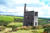 |
The remains of the engine house of Wheal Betsy
(SX 510812) - an old lead and copper mine that closed in 1877.
There are old workings, spoil tips, dry
channels and old shafts all around.
|
 |
The dog enclosure of Ditsworthy Warren House with 2 kennels
built into the wall. At one time this would have housed a pack
of 17 rabbiting dogs (plus ferrets). (SX 584662). This was the
centre of an extensive warren business in the 19th century.
|
 |
An old rabbit burrow just outside Trowlesworthy Warren farm
entrance - what the OS map calls "pillow mounds". Burrows
were made of piles of stones, covered with earth and a trench dug
around
them to maintain
drainage. Within a burrow would live lots of rabbits. |
 |
A lookout on the west side of Huntingdon Hill. This curious
structure was built around 1850 to protect the warren from poachers
- particularly those working at Redlake. There's a small chimney
which doubtless was used on cold nights. |
 |
A stone marking the start of one of Frank Phillpott's peat passes
at SX 612814.
|
 |
Keble Martin's chapel at SX 667667 - near Huntingdon Warren.
This was built in the early 20th century by a group of young men
led
by
Keble
Martin
the famous
botanist and sometime vicar of Dartington.
|
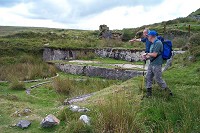 |
Jim pointing out the remains of the new mill at Hooten Wheals
(SX 655708). Years ago all this would have been inside a shed.
(SX 656708).
|
 |
The circular buddle of Golden Dagger mine - SX 685799. Buddles washed
the tin ore by means of rotating brushes that led off from the
central dome. The heaviest tin particles sank to the bottom.
|
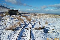 |
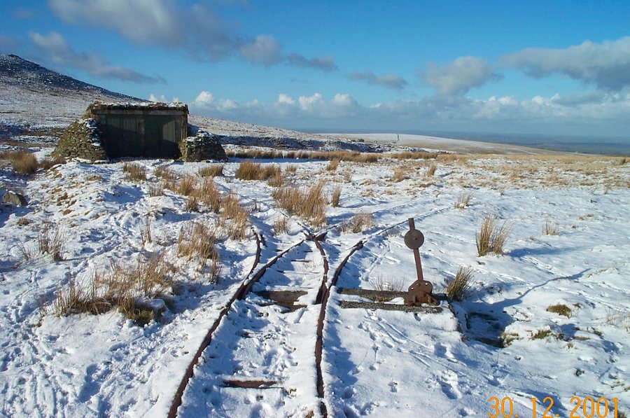
The military railway points at SX 593911. This was a target railway
where a small trolley carrying wooden targets was used to provide
shooting practice for soldiers.
|
 |
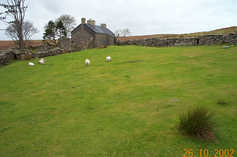
John Bishop's house - SX 640726. This was built by a robust and
hard working Dartmoor settler of the 19th century. This house has
only become dilapidated quite recently. In 1968 it still had a
roof.
|
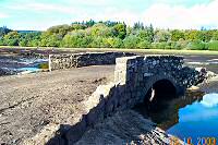 |
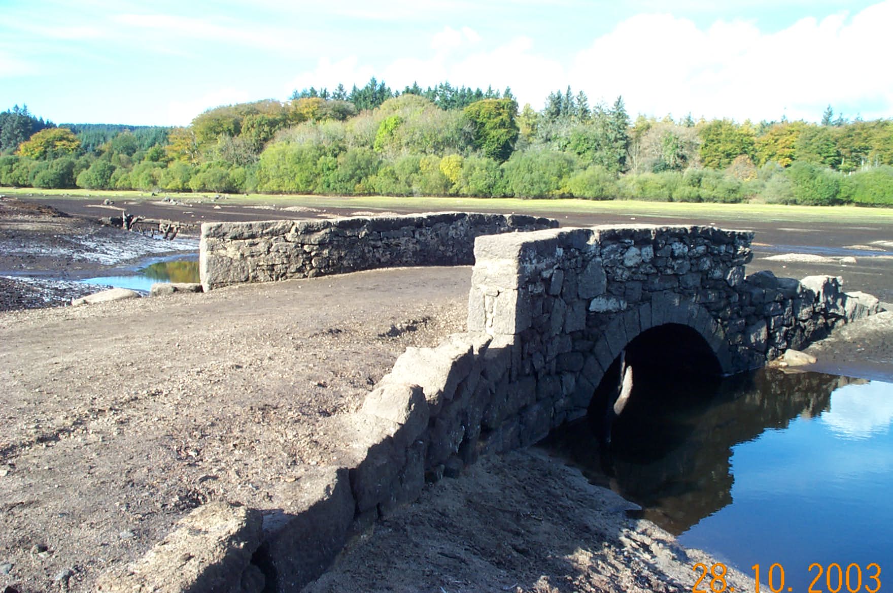
A usually submerged bridge exposed at low water at Fernworthy
reservoir - SX 660838. |
 |
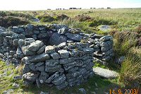
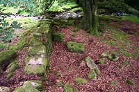
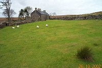
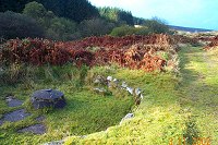
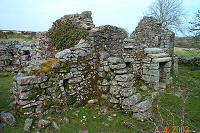
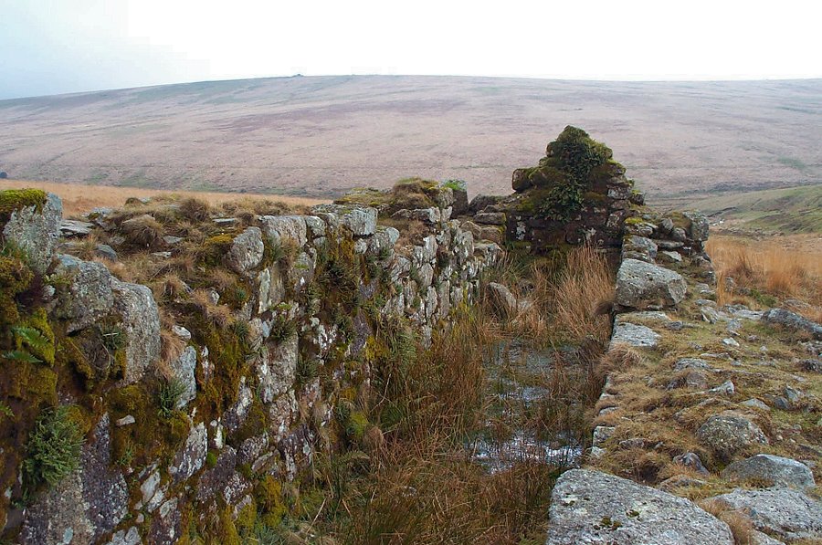
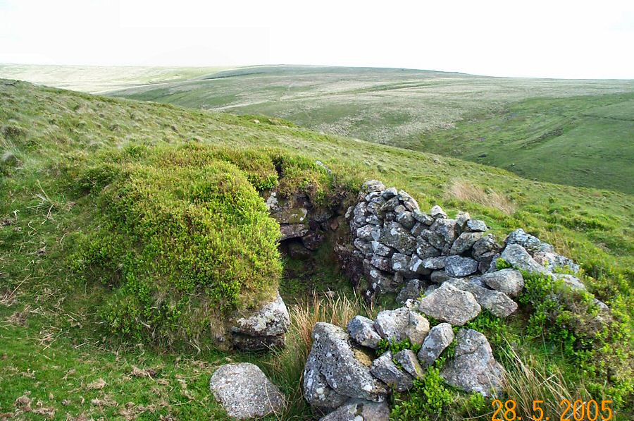
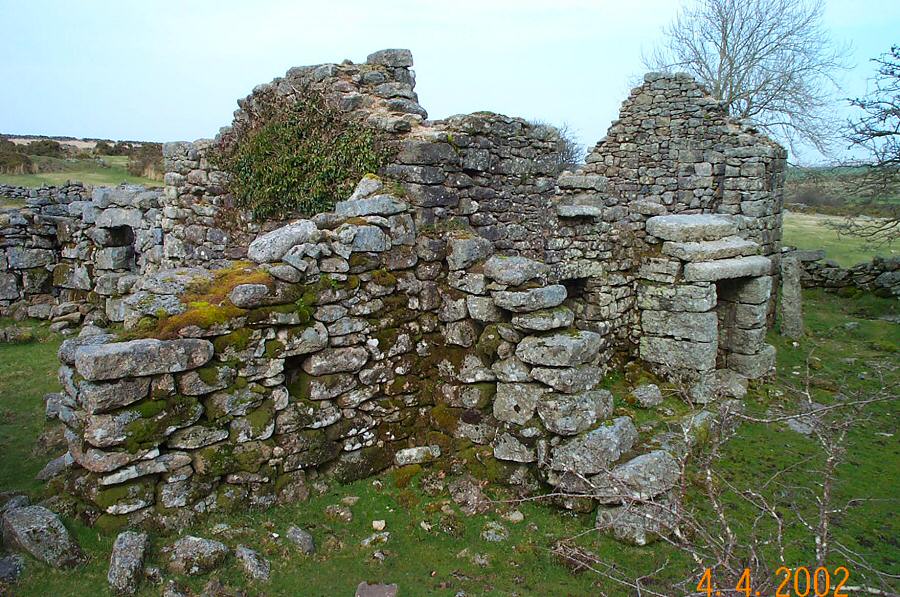
Some of the ruins of Doe Tor Farm - SX 536849. The farm was abandoned
in 1955.
|
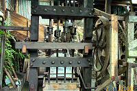 |
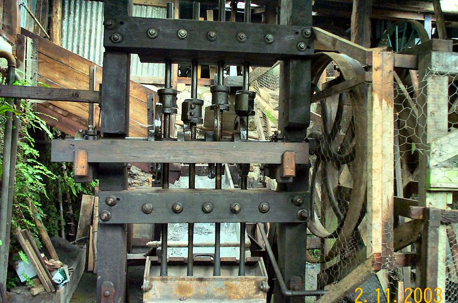
Californian stamps at Kelly Mine - SX 795818. The stamps were
used to pound orestone. Once upon a time stamps like these would
be
found
wherever mining took
place
on
Dartmoor.
There
are only 2 sets left in the UK. The mine used to produce micaceous
haematite for corrosion resistant paint. It closed in 1951 after
150 years of work. |


